Following a lightning storm in the Revelstoke area on Friday (July 21), several wildfires of various sizes are burning throughout the Southeast Fire Centre.
The biggest and closest wildfire to Revelstoke is located at Hiren Creek, northwest of Revelstoke near the Jordan River.
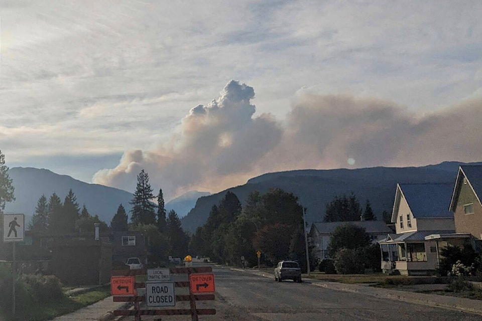
The BC Wildfire Service says that the fire was caused by lightning and started burning on Friday (July 21). On the morning of July 23, a response officer was able to track the fire and determined its size to be approximately 150 hectares.
“This fire is burning in a steep and mountainous area that crews are unable to safely access. It is a modified response, as such it will be flown regularly to monitor fire activity and growth,” said BC Wildfire.
“As gusty winds are forecast for the area beginning this afternoon until Wednesday, smoke from this fire will continue to be visible from Revelstoke and surrounding areas. This fire originated at a high elevation and no structures or infrastructure are threatened at this time.”
To the northeast, several small fires, all caused by lightning, are burning in the area of Kinbasket Lake, most of which are less than one hectare in size. Near Ambleside Creek, a 15-hectare wildfire is burning ‘out of control’ according to the BC Wildfire Service.
At Norman Woods Creek, about 140 km north of Revelstoke, a 60-hectare wildfire caused by lightning was discovered on July 23. That fire is burning ‘out of control’ and being fought with a combination of techniques by the BC Wildfire Service.
There are 488 active wildfires burning throughout the province.
As of July 17, the province had seen a total of 1,159 wildfires, destroying more than 1.39 million hectares, making it the worst wildfire season on record for the province in terms of the amount of land burned.
Visit wildfiresituation.nrs.gov.bc.ca/map for the full list of active wildfires in the area.
READ MORE: ‘Vigorous’ and ‘dangerous’ wildfire north of Chase now 2,000 ha
READ MORE: New evacuation alerts in Thompson-Nicola for second blaze north of Chase
@josh_piercey
josh.piercey@revelstokereview.com
Like us on Facebook and follow us on Twitter.